Wildfire Risk in San Juan Water Conservancy District
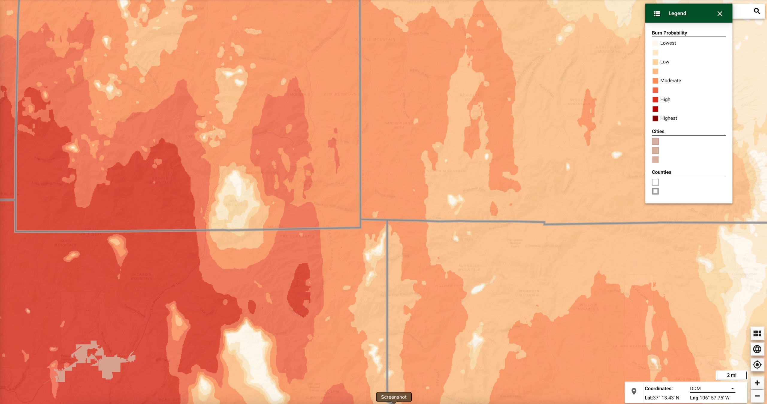
The Colorado Wildfire Risk Map indicates that wildfire danger in Archuleta County is significant. The Colorado State Forest Service researches conditions on the ground and provides the public with an on-line Wildfire Risk Viewer. https://co-pub.coloradoforestatlas.org/#/
The cropped image above shows the SJWCD watershed in Archuleta, Hinsdale, and Mineral Counties. The lower left section of the map is the Pagosa Area Water and Sanitation District watershed. This is where our municipal water comes from. The upper right section of the map includes Running Iron Ranch, the proposed location of a small water storage reservoir. (According to the State of Colorado and the U.S. Bureau of Reclamation, 11,000 acre feet is a small reservoir.) The mission of all legislated Colorado Conservancy Districts is to ensure water for all uses for the future.